By: A data engineer who’s spent far too many hours untangling zoning codes, parsing LEPs, and wondering why we don’t just build moats instead of fences.
Dreaming of A Castle in Castle Hill?
You’ve got a dream — turrets, towers, and maybe even a drawbridge.
But the system?
The system has other plans. Here’s why that dream castle on Castle Street in Castle Hill is going nowhere fast.
It sounds whimsical, but this hypothetical helps illuminate a real-world complexity: what you can do with land is defined not just by ownership or ambition, but by layered planning instruments, local policies, and strict zoning controls.
Let me take you on a journey through the grid-based world of Australian planning rules and break down why you can’t build a castle in Castle Hill.
I’ll show how structured planning data can be the difference between imagination and implementation.
Land Isn’t Just Land, It’s a Parcel
The first thing you need to understand: land isn’t just a physical space, it’s a parcel, which is a geospatial unit of land recorded in a digital cadastral database.
A parcel in a cadastre contains coordinates, legal identifiers, zoning, overlays, and constraints.
In property planning, it’s a deeply opinionated personality defined by planning instruments (or legal documents defining planning rules).
These parcels are mapped in Australia’s cadastre, a digital model that helps planners, surveyors, and your local council make decisions in 3D.
Understanding Cadastres
Learn about Australia’s cadastres, what they are, how they’re stored and used.
Planning Rules Define Possibility, Not Just Restrictions
Every parcel of land is governed by layers of planning rules.
Now let’s go back to your dream of building a castle in Castle Hill to examine this in more detail…
Castle Street, Castle Hill 2154 New South Wales (NSW) Scenario
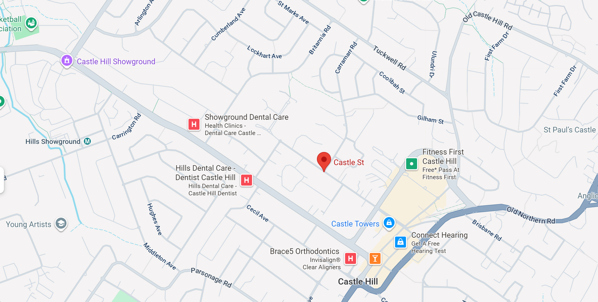
Source: Google Maps
Zoning (LEP)
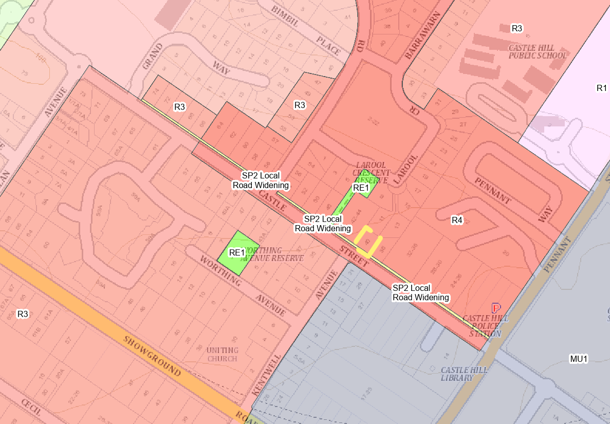
Castle Hill’s zoning is not uniform. It is predominantly R1 General Residential and R2 Low-Density Residential zones with significant areas of R3 Medium-Density Residential and R4 High-Density Residential (particularly around the Castle Hill Metro and Showground Station precincts).
Parts of Castle Street near Castle Hill Metro is zoned R3 (Medium Density Residential) and R4 (High-Density Residential) under The Hills Local Environmental Plan or LEP (see the NSW Planning Portal Spatial Viewer of Council’s interactive map for site specific verification).
| R3 – Medium Density Residential | R4 – High Density Residential | |
| Purpose | Provides for a variety of medium density housing in accessible locations. Intended to transition between low-density suburbs and higher-density centres. | Provides for the highest level of residential density. Intended for areas near centres, transport hubs, or growth precincts. Objectives are set in the Standard Instrument LEP and adopted in The Hills LEP 2019. |
| Typical Housing Forms | Townhouses, villas, duplexes, small apartment blocks (2–3 storeys), terraces. | Multi-storey apartment buildings (4+ storeys), large residential flat buildings, mixed-use with residential components. |
| Density | Moderate density: balances suburban character with more efficient land use. | High density: intended for significant urban consolidation and population growth. |
| Height (default under SEPP Low- & Mid-Rise Housing Policy) | Outer band (400–800m): up to 17.5m (approximately 4 storeys) | Inner band (0–400m): up to 22m (approximately 6 storeys) |
| Floor Space Ratio (FSR) | FSR 1.5:1 | FSR 2.2:1 |
| Local Variations (LEP/DCP) | Councils set base zoning/FST/height and may set additional controls in the LEP (statutory) and give design guidance (setbacks, privacy, landscaping) in a DCP (non-statutory guidance). In Low and Mid-Rise (LMR) areas, non-discretionary (non-refusal) standards prevail over stricter LEP/DCP for the same matters. | Same as R3. Always confirm site-specific LEP/DCP provisions. |
| Location Suitability | Suburban streets within walking distance of local shops, schools, or transit corridors. | Activity centres, major roads, town centres, and transport nodes like Metro stations. |
Important Site-Specific Applicability:
- Scope: The height/FSR figures shown here apply only to lots mapped in NSW’s Low & Mid-Rise (LMR) Housing areas and not in an excluded category. If a lot is outside LMR mapping, the LEP height/FSR controls apply.
- Separate program: Transport-Oriented Development (TOD) controls apply only to sites within 400 m of selected stations shown on the official TOD maps. Where TOD applies, different standards may apply (e.g., height 22–24m, FSR up to ~2.5:1). Only TOD numbers are used if the site is inside the TOD map.
State Environmental Planning Policies (SEPPs)
Each state has overarching policies to “guide” councils and developers. NSW consolidated dozens of SEPPs into 11 principal SEPPs in 2022. These are statutory instruments that can override LEPs if inconsistent.
Want to build something outside the norm?
It would still have to fit under a SEPP.
Development Control Plan (DCP)
The DCP is where things like street setbacks, privacy screens, landscaping, and sunlight access are defined.
DCPs provide detailed design guidance that supports (but does not override) LEP/SEPP controls; consent authorities must consider DCPs, but LEP/SEPP standards prevail.
New South Wales (NSW)
Broadly, the hierarchy of planning policies in NSW goes:
- State Environmental Planning Policies or SEPP (statewide) →
- Local Environmental Plans or LEP (council wide) →
- Development Control Plans or DCP (neighbourhood wide)
Each provides restrictions and controls of what can and can’t be built.
Under NSW planning law, if a SEPP and an LEP conflict, the SEPP generally prevails—but only to the extent of the inconsistency (unless the instrument says otherwise). This means the SEPP overrides only the part that clashes; the rest of the LEP still applies.
For NSW zoning info, see NSW Planning Portal Spatial Viewer.
A Broader Comparison of the Eastern Australian States
Let’s break down how these work using real-world examples across a typical residential parcel by comparing our New South Wales example to equivalent examples in Castle Streets in Victoria and Queensland.
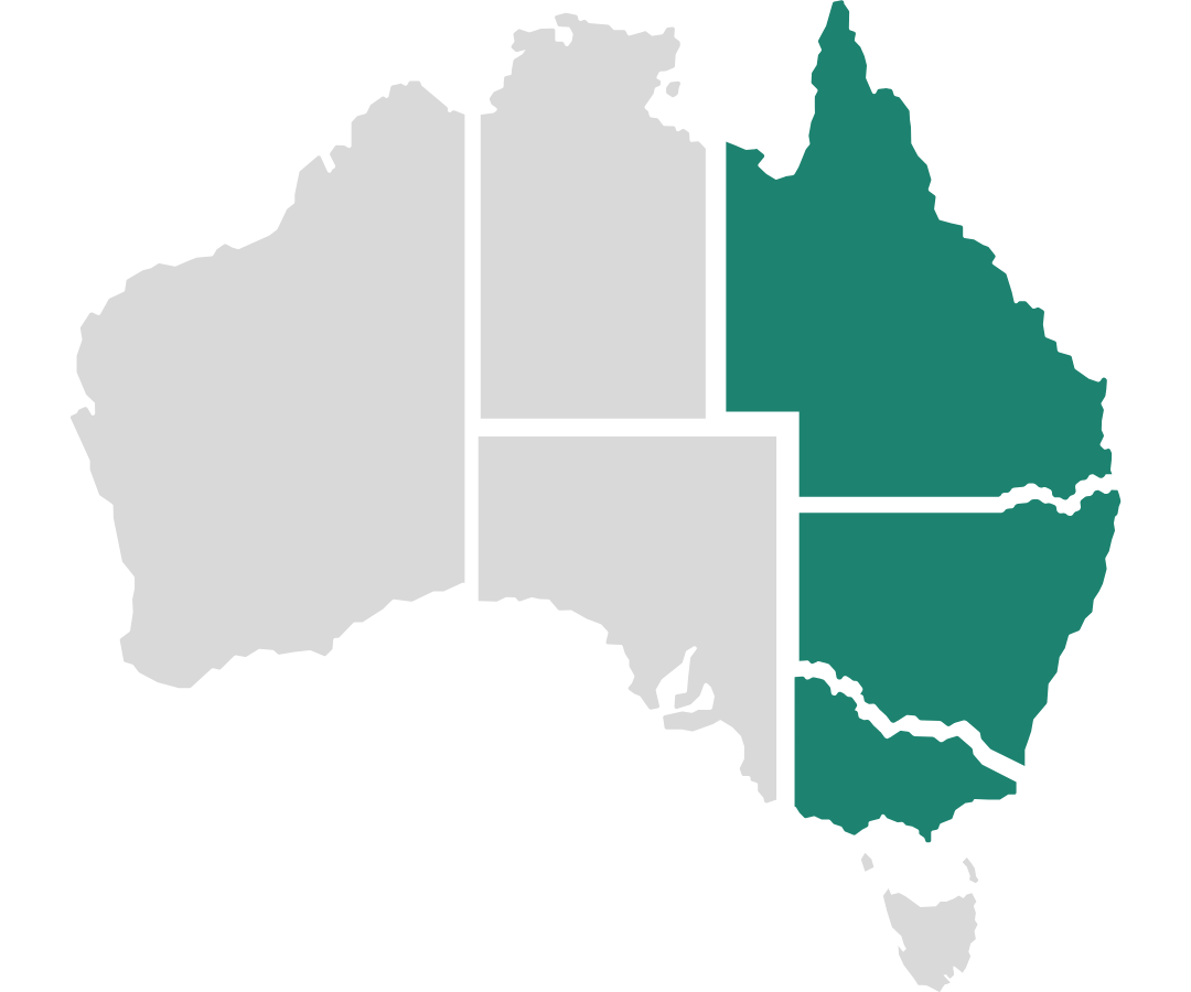
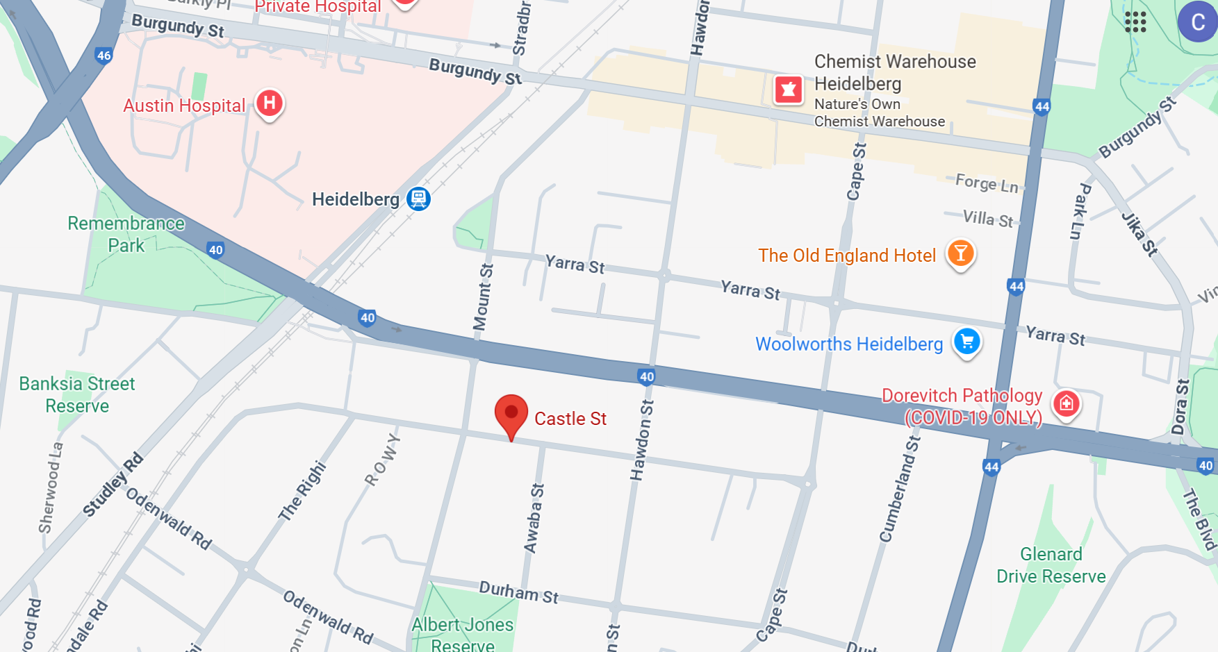
Victoria (VIC) – Castle Street in Eaglemont 3084
Zoning (Local Planning Scheme)
Eaglemont streets commonly sit in a General Residential Zone and schedule numbers vary by property. GRZ sets a default building height of 11m or 3 storeys (unless otherwise specified in a schedule or by overlays/heritage).
Check the property’s exact schedule in the Banyule Planning Scheme. These Local Planning Schemes in Victoria are comparable to the LEP’s of NSW in providing guidance on what can and can’t be built.
Victoria Planning Provisions (VPP)
The VPP is a statewide set of provisions/zone clauses that local schemes adopt.
The VPP provides statewide consistency by providing a framework for local councils to create their Local Planning Schemes from. It contains controls (e.g., zone purposes, use tables, height provisions) and local schedules fine-tune them.
Neighbourhood Character Overlays (NCOs)
NCOs add further nuance to development controls, often influencing form, façade, and street context.
Akin to the NSW DCP these provide a more nuanced set of restrictions on a development.
In VIC, development controls are more predictable thanks to VPPs. We extract structured zoning and overlay data to power predictive models for development potential.
For VIC zoning info, see www.planning.vic.gov.au.
Source: Google Maps
Queensland (QLD) – Castle Street in Fairfield 4103
Zoning
In QLD, each council has its own local planning scheme (with non-standardised naming).
Brisbane assesses developments under Brisbane City Plan 2014.
On Castle Street, Fairfield 4103, many lots fall within the Character residential zone and the Traditional building character (pre-1947) overlay.
Together these controls aim to retain the historic streetscape and typically support low-rise outcomes; about two storeys (~9.5 m), subject to the specific lot, precinct and neighbourhood plan provisions.
This example means 1 or 2 story houses that reflect the design styles of circa 1946.
See Brisbane City Council City Plan 2014 for 11 Castle Street, Fairfield 4103.
To confirm the exact zoning/overlays for individual lots, visit City Plan Online.
Unlike NSW and VIC these zoning rules are not standardised and vary from council to council. The definition, zoning code vary greatly between each council.
State Planning Policies (SPPs)
In QLD, State Planning Policies (SPPs) are helpful and covers requirements for environmental hazards, transport corridors, and other macro factors, but practically leave councils to do their own thing, hence zoning varies widely across councils.
QLD is the least standardised across the eastern states.
For QLD, see Help Section – Queensland Globe, to navigate the state’s mapping platform or Queensland zoning information | Planning to understand zones for QLD parcels. To find the exact zone for a parcel you should check the relevant council’s planning scheme map (such as Brisbane City Plan Online).
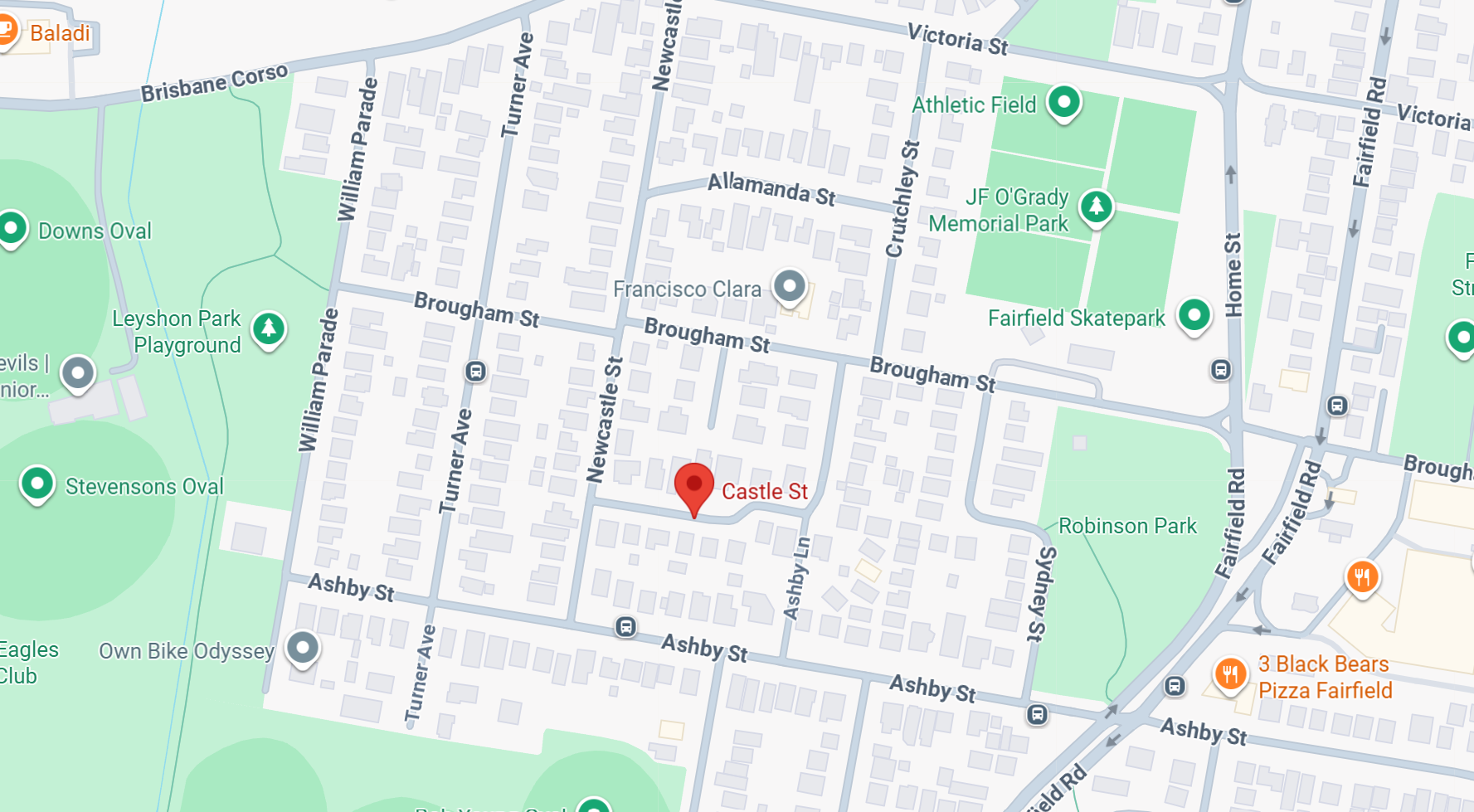
Source: Google Maps
Zoning, Overlays, and the Real Limits on Development
Zoning, overlays, and planning policies form a layered rules engine that dictates what’s possible, and what’s not, on every parcel of land. These frameworks control everything from height limits and building types to setbacks, lot size, waste access, and even neighbourhood character.
You’re evaluating what can be done with it, based on a location-specific matrix of planning rules and policy constraints.
Sometimes there’s room to manoeuvre.
But even then, the outcome must still align with local design expectations.
A development may comply on paper, but if it disrupts neighbourhood privacy, sunlight, or streetscape character, it’s unlikely to fly.
The Verdict?
Unfortunately, no, it’s unlikely you can build your dream castle on Castle Street in Castle Hill 2154, Eaglemont 3084, or Fairfield 4103.
Not because the block is too small.
Not because you lack ambition.
But because the rules, encoded across multiple planning layers, simply don’t permit it.
Turn Rules into Results
Gauging true development potential means going beyond a zoning map.
Across every state and territory, what gets built is shaped by the interplay of state/territory policy, local planning schemes, and codes and overlays that regulate height, density, setbacks, access, neighbourhood character, heritage, flooding and bushfire risk.
In practical terms, start by confirming the planning assessment pathway and any referrals/notification, then the building approval pathway.
Next, identify infrastructure contributions, easements and servicing constraints, and model yield, cost and risk against the site-specific controls that actually apply to your lot.
This allows you to recognise where opportunities exist, or where constraints are non-negotiable.
With the right information, you can plan smarter, faster, and with greater certainty.
The information in this article is provided in good faith for general guidance only. It is not a substitute for planning, legal or financial advice. Controls and processes such as zoning and scheme provisions, overlays, state planning instruments including SEPPs, VPPs and SPPs, assessment pathways, referrals and notifications, and infrastructure contributions can change and may apply differently to individual sites. Always verify current requirements with official sources, including the relevant state or territory planning instruments and your local planning scheme, and obtain advice from suitably qualified professionals before acting. We make no representation or warranty regarding the accuracy, completeness or timeliness of the content and accept no responsibility for any loss or damage arising from its use. External resources are provided for context and do not imply endorsement.
Australian Cadastre Data
Access trusted Australia’s cadastre data at your fingertips, instantly accessible and ready to query in Snowflake. Only available from the Snowflake Marketplace.
More Intel from Data Army
Intel In Your Inbox
Sign up to our newsletter and receive our latest knowledge articles, practical guides and datasets.

